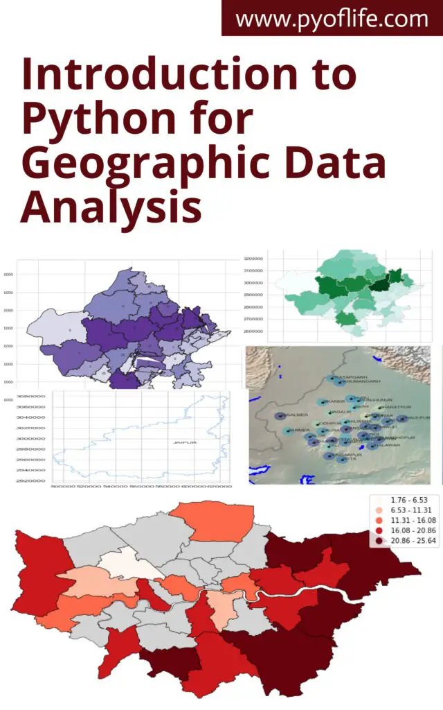
Introduction to Python for Geographic Data Analysis: In the realm of data science, Python has emerged as a versatile and powerful tool, finding applications across various domains. One such domain where Python shines is Geographic Data Analysis. As geospatial data becomes increasingly prevalent, the ability to analyze and interpret this data is essential. Python, with its robust ecosystem of libraries, provides an excellent platform for geographic data analysis, enabling users to perform tasks ranging from simple data manipulation to complex spatial computations and visualizations. This blog aims to introduce you to the basics of using Python for geographic data analysis, exploring the essential libraries, tools, and concepts.
Understanding Geographic Data
Before diving into Python, it’s crucial to understand what geographic data is. Geographic data, also known as geospatial data, refers to information that describes the locations and characteristics of features on Earth. This data is often represented in two forms:
- Vector Data: This consists of points, lines, and polygons that represent different features like cities, rivers, and country boundaries. Each feature can have associated attributes, such as population for cities or length for rivers.
- Raster Data: This represents data in a grid format, with each cell containing a value. Examples include satellite imagery, elevation data, and land cover classifications.
Geographic data can be stored in various formats, such as shapefiles, GeoJSON, and raster files like GeoTIFF. The ability to handle these formats efficiently is key to effective geographic data analysis.
Why Use Python for Geographic Data Analysis?
Python has become the language of choice for many in the geospatial community for several reasons:
- Extensive Libraries: Python offers a wide range of libraries specifically designed for geospatial data analysis, such as
Geopandas,Shapely,Fiona,Rasterio, andPyproj. - Ease of Use: Python’s syntax is straightforward, making it accessible for beginners and powerful enough for advanced users.
- Integration with Other Tools: Python easily integrates with other data science tools and libraries, such as
Pandasfor data manipulation,MatplotlibandSeabornfor visualization, andScikit-learnfor machine learning. - Community Support: Python has a vast and active community, ensuring continuous development and support, along with a wealth of tutorials and documentation.
Getting Started with Python Libraries for Geographic Data Analysis
To start with geographic data analysis in Python, it’s essential to become familiar with some key libraries that form the foundation of most geospatial workflows.
1. Geopandas
Geopandas is an extension of the popular Pandas library, specifically designed to handle spatial data. It allows you to work with spatial data as easily as you would with a regular DataFrame in Pandas. With Geopandas, you can read, write, and manipulate vector data, perform spatial operations, and conduct spatial joins.
Example:
import geopandas as gpd

# Load a shapefile
world = gpd.read_file(gpd.datasets.get_path('naturalearth_lowres'))

# Display the first few rows
print(world.head())

# Plot the data
world.plot()
2. Shapely
Shapely is a powerful library for performing geometric operations. It enables the manipulation and analysis of planar geometric objects like points, lines, and polygons. Shapely is often used in conjunction with Geopandas to perform operations such as buffering, intersection, and union.
Example:
from shapely.geometry import Point, Polygon

# Create a Point and a Polygon
point = Point(1, 1)
polygon = Polygon([(0, 0), (2, 0), (2, 2), (0, 2)])

# Check if the point is within the polygon
print(point.within(polygon))
3. Fiona
Fiona is used for reading and writing vector data files. It provides a simple and efficient interface for handling formats like shapefiles and GeoJSON, making it an essential tool for managing geospatial data.
Example:
import fiona

# Open a shapefile
with fiona.open('path_to_shapefile.shp') as src:
    for feature in src:
        print(feature)
4. Rasterio
For working with raster data, Rasterio is the go-to library. It allows you to read and write raster datasets, perform resampling, and conduct various analyses on raster data.
Example:
import rasterio

# Open a raster file
with rasterio.open('path_to_raster.tif') as src:
    print(src.profile)

    # Read the first band
    band1 = src.read(1)
5. Pyproj
Pyproj is used for performing cartographic projections and transformations. Geospatial data often comes in different coordinate reference systems (CRS), and Pyproj helps in transforming this data into a common CRS for analysis.
Example:
from pyproj import Proj, transform

# Define two coordinate systems
wgs84 = Proj(init='epsg:4326')
utm = Proj(init='epsg:32633')

# Transform a point from WGS84 to UTM
x, y = transform(wgs84, utm, 12.4924, 41.8902)
print(x, y)
Practical Example: Analyzing Geographic Data with Python
Let’s combine these libraries in a simple example where we analyze geographic data to identify regions within a specified distance from a point of interest.
Scenario: Suppose we want to identify all countries within 1000 kilometers of a given location (e.g., a city).
Steps:
- Load the data: Use
Geopandasto load a dataset of world countries. - Define the point of interest: Create a point representing the location.
- Buffer the point: Use
Shapelyto create a buffer around the point. - Perform spatial join: Use
Geopandasto identify countries within the buffer.
Code:
import geopandas as gpd
from shapely.geometry import Point

# Load world countries data
world = gpd.read_file(gpd.datasets.get_path('naturalearth_lowres'))

# Define the point of interest (e.g., Rome, Italy)
point = Point(12.4924, 41.8902)  # Longitude, Latitude

# Create a GeoSeries for the point
gdf_point = gpd.GeoSeries([point], crs="EPSG:4326")

# Buffer the point by 1000 km (use an appropriate projection)
gdf_point = gdf_point.to_crs(world.crs)
buffer = gdf_point.buffer(1000000)  # Buffer in meters

# Perform spatial join to find countries within the buffer
countries_within_buffer = world[world.intersects(buffer.unary_union)]

# Plot the result
ax = world.plot(color='lightgrey')
countries_within_buffer.plot(ax=ax, color='blue')
gdf_point.plot(ax=ax, color='red')
Conclusion
Python offers a comprehensive toolkit for geographic data analysis, enabling users to handle and analyze both vector and raster data with ease. Libraries like Geopandas, Shapely, Fiona, Rasterio, and Pyproj form the backbone of geospatial workflows in Python. With these tools, you can perform a wide range of tasks, from basic data manipulation to advanced spatial analysis and visualization. Whether you’re a beginner or an experienced analyst, Python provides the flexibility and power needed to unlock the full potential of geographic data.